Today’s journey takes us to another holy of holies of the Armenian Cosmos, a country where the Armenian nation was formed, where one of the first Armenian states took shape in the 2nd millennium BC. This country was called the House of Torgom.
Traditions and legends of all the most ancient nations – Armenian, Jewish, Persian, and others – connect the origin of all peoples to the forefather of modern humanity Noah, who by the will of the Creator survived the flood with his ark and eventually came to rest on the mountains of Ararat. This happened, according to the biblical chronology, in the middle of the 4th millennium BC.
Noah had three sons – Sim or Shem, Qam or Ham, and Hapet or Japheth.
Unlike, say, the Jews and the Arabs who descended from the descendants of Sim-Shem and were therefore called the Semitic peoples, the Armenians are the descendants of Hapet-Japheth and belong to the so-called “Japethic” nations. This is a terminology based on the Bible. In the Armenian tradition, traveling across Sasun, the name of Shem firmly settled in the Armenian Highlands.
Be that as it may, from Hapet was born Gomer (whose name served as the eponym of the country Gamirk at the junction of Armenia, Cilicia, and Cappadocia). From Gomer was born Tiras (the namesake of one of the main gods of the ancient Armenian pantheon Tir). Tiras fathered Torgom, the father of Hayk Nahapet.
No wonder that Movses Khorenatsi, narrating about the Haykian period of Armenian ancient history, stresses that Hayk, who along with his clan had participated in the construction of the Tower of Babel, rose against the tyrant Bel and returned to his ancestral homeland Armenia.
Many researchers consider the name of Hapet to be preserved in the name of the famous Npat mountain in the upper reaches of the Aratsani River, from where Armenian King Pap watched the Battle of Dzirav in 371 AD. Several other mountains and ranges in Armenia also carry the name of Npat.
The country that was given a name by Torgom lied in the extreme west of Armenia, near the borders of Cilicia and Cappadocia, in the basin of the largest right tributary of the Euphrates River Melas (now Tohma), between Malatya, Sebastia, and Caesarea, directly adjacent to the Hittite country.
Called the “House of Torgom” by Armenians, this country is mentioned in the most ancient Hittite, Jewish, Aramaic, and other sources under the names of Togarma, Tegarama, Til-Garimmu, or Til-Gurimmi. In addition to the direct eponym “Torgom”, the name of the country can be derived from the oldest roots “tog” (clan, nation, house) and “arma” – Armenian.
It was here that the Armenian nation was originally formed, it was from here that the numerous tribes of the Torgom family left for the Armenian Highlands, it was from here that Hayk Nahapet descended into Babylon, and it was here, according to the geography of all the most ancient peoples, that the Country of Armenia or Gund Araratyan, a country of sun-born Armens, the country of the son of Torgom and the patriarch of Armenians Hayk Nahapet was located.
In later centuries, this land was called Second Armenia, being one of the provinces of Lesser Armenia. Now, it is part of the Turkish Malatya Province. By the name of the country, its capital was also called House of Torgom.
One of the country’s names – Til-Garimmu (Til-Gurimmi) – over the course of further linguistic transformations gradually turned into Gorene, Gavrene, Gorin, and, finally, Kyurin. This was the name by which this ancient Armenian city has been known throughout the Middle Ages. Now, the city bears the name Gürün.
The city is located 110 km northwest of Malatya. It lies on both banks of the Melas-Tokhma river, in the northern foothills of the Voromandon mountain range in the Southern Taurus mountain complex.
In the vicinity of the city of Torgom-Kyurin is the district of Karnak or Garnak. Here can be seen an analogy with the Egyptian Karnak temples. Originating from the name of Garnik, a descendant of Hayk, the name “Karnak”, which is closely intertwined with the root “kar” (Armenian: “stone”), directly or indirectly participated in the formation of the names of the famous village of Garni, the cities of Karin and Kars, as well as a dozen other Armenian names.
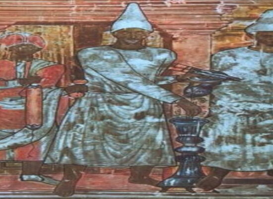
Armenians had a church and a school in Kyurin. Prominent representatives of Armenian culture were born in this city as well, including musician and composer M. Tumachyan (a student of Armenian composer Komitas), poet Vahe Vakhyan, and many others.
7 km downstream of Melas, between the villages of Karnak, Partizak (Armenian: “small garden”, formerly Bakhchajur), and Hin Qaghak (Old Town, now Karakhisar) lies the monastery of St. Tagavor (literally translated as “Holy King”).
Further down the river, 37 km from Kyurin lies the city of Daranda or Tarente, which at one time was a famous center of the Pavlikian (Paulician) movement. The city was famous for its impregnable fortress, which was simply called Shenk (Armenian: “building”). In Daranda, there were three Armenian churches, a school, and a monastery named Surb Astvatsatsin (Holy Mother of God).
Directly to the west of the city is the Ashotadzor gorge with the river of the same name, which is the right tributary of Melas. The famous village of Ashoti is also here. It houses a monastery, church, school, and even an inn.
97 km northwest of Kyurin, on the road to Gamirk-Kamarak (today Gemerek), on the very border of Armenia with Cappadocia lied the large village of Svkhun or Svkhyn. At the beginning of the 20th century, more than 2.000 Armenians lived here.
Next to Svkhun stretches the Anti-Taurus mountain range, one of the ridges of which was called Khndzori (Armenian: “apple”, now Khinzir). A monastery once lied in one of its ledges. Called Khndzori Astvatsatsin, it was one of the centers of the Armenian medieval literature.
The Tsamndav Plateau, a desert karstic plateau stretching to the east of the Anti-Taurus mountains, originates from the Tsamndav River (Zamanti in Turkish), which is the right-hand tributary of the largest Cilician river, Saros (now Seyhan).
On the plateau, in the headwaters of Tsamndav once was the large village of Pohrenk with the Surb Astvatsatsin church (by the way, the cult of the Mother of God spread in Armenia no less than the cult of Jesus himself). Down the river, at the very beginning of the Tsamndav gorge was the city of Tsamndav (now Aziziye).
In the opposite eastern part of the Tsamndav plateau, in the foothills of the Bazeyitevk range (Armenian:
“falcon wings”, in the Greek tradition – Zigon-Basiteon) lies another large and famous village that used to be called Manchnuk or Mangini (now Manjilukh). The monastery of Surb Theodoros was located here. Near the village are the ruins of ancient Larissa, and to the north of it is a karst hill called Seghanasar (Armenian: “Table Mountain”). This hill has an almost flat surface, hence the name.
Further to the east, between the House of Torgom and the district of Arabkir stretches an ancient road from Sebastia to Malatya. On it, in the southern foothills of Bazeyitevk, on the eastern slope of Mount Vank lies the ancient village of Vank with the monastery Surb Nshan.
In ancient times, there was an inn and a road station called Ad-Pretorium in the place of this village. This inn along with the station was indicated on the Tabula Peutingeriana. Later, the settlement of Hasan Çelebi appeared in its place. In general, the heterogeneous toponym Hassan, which is very often found in the Armenian Highlands, has a very concrete Armenian linguistic toponymic basis.
This name comes from the Armenian word “ketsan”, meaning “refuge”, “residence”. Turks use the root “chelebi” with the meaning “noble”, “aristocratic”. This root was frequently used by them to denote outstanding Armenians.
Another large inn used to be located 22 kilometers south of Vank. It was called simply Ijevan (Armenian: “ijevanatun”, “inn”). It would be expanded into a village named Hekimkhan.
“Khan” in Turkic toponymy means “inn”, “caravanserai.” The root originates from the Armenian “kan”, which is the ending for the names of Armenian settlement Arzakan, the former Leninakan and Kirovakan, Kstakan, etc.
Finally, in the extreme east of the House of Torgom, within the Arabkir District of Lesser Armenia lied a city that is now called Argowan or Arguvan. Its name is the legacy of the ancient toponym “Arkavan” (Armenian: “Kingly village”) or alternatively the name “Argavand” (“fertile”).
In the old days, this city was known as Argaus or Argauna. Later, the village of Mokhrakut (literally, “ashes”) was built on its site after it had been ruined. Around two dozen of the once lively and populous Armenian villages are scattered around Arguvan. Each of the villages had a school and a church, or even two or three. The most famous among them are Ashutka and Itsagegh (Isakey).
Grigor Beglaryan