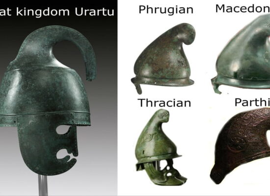
Ancient Greeks considered the Armenian Highlands as the heart of the world. According to their records, the plateau was situated south and in the middle of Black and Caspian Seas, as well as in between of the Mediterranean Basin and the Persian Gulf.
Armenian Highlands was connected to the Black Sea via the Akampsis river (nowadays Çoruh River), to the Caspian Sea through Aras (Araxes) river, and to the Persian Gulf through Tigris and Euphrates, the latter being a passageway to the Mediterranean coast as well.
Greek geographers placed the Armenian Upland in the center of their maps.
Source: Cyclopædia of Biblical, Theological, and Ecclesiastical Literature (1894)