The northern part of the Kars region is occupied by the Artaan district, which has preserved its historical name since time immemorial – in ancient times this territory constituted the vast gavar Artaan of Gugark ashkhar of Great Armenia.
The center of the gavar, as well as subsequently – the mentioned district was the city of Artaan, which is now the administrative center of the province of the same name in Western Armenia. The Artaan Gavar occupies the basin of the headwaters and the sources of the major river Kur or Kor, which translates from Armenian as “winding”.
In the Russian language, the variant Kura is accepted – in accordance with the term “river” of the female gender – just as in the case with French hydronyms Seine, Saône, Rhône, Garonne, and so on. Georgians call this river Mtkvari. After the Euphrates and the Tigris, the river Kur is the third longest and the third-largest basin river of the Armenian Highlands.
It originates on the Konder plateau (Hills) northwest of Kars, flows sequentially to the northeast, east, and southeast and flows into the Caspian Sea within the limits of Paytakaran – the easternmost gavar of Great Armenia.
The city of Artaan is located on the eponymous marshy plain in the upper course of the Kur river, at first – on its right bank, then – on both banks. The Artaan plain stretches in a latitudinal direction for 18-20 km along the course of the river, it is bordered on the south by the medium-altitude ranges Abehenk and Khorzhenkar, and on the north – by the spurs of the Arsiaats or Arsiatsky ridge.
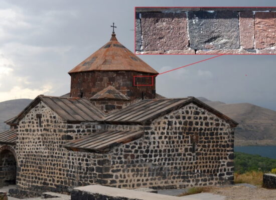
The average height of the Artaan plain above sea level is 1800 m, its climate is cold continental, winter often lasts up to 7-8 months. Artaan, located on the right bank of the Kura, suffered from a major fire in 1892, after which a new quarter – Nor Takh was laid on the left bank. In the old one (Khin Takh), on a rocky cliff, there was the fortress of Artaan.
According to Armenian and Georgian historians, the Artaan fortress was laid during the Urartu period. The Armenian king Yervand Arshakuni, who rebuilt it, settled the fortress with “people with rough speech” (“divakhos” – literally “demon-speakers”) and renamed it to Kadjatun, and the city that surrounded it began to be called Kadjats Kahak. Here it is necessary to make a “lyrical digression”.
Recurring in Armenia more than a hundred times, toponyms with the root “kadj” (among others – the Syunik Kajaran) have nothing to do with the word “kadj” – “brave”. This is a classic example of a later reinterpretation of the forgotten ancient root “kadjk”: in the ancient Armenian pantheon, it is a numerous group of rough and evil spirits of mountains, dungeons and other hard-to-reach places, unlike “alk” – good spirits of lakes, meadows, and forests (“k” – in both cases – the ending of the plural, accepted in Grabar), – the root, in turn, reinterpreted into “al” (“bright red”, “scarlet”).
Thus, all names like Kadjatun, Kajaran or Alvard, Alberd (Alaverdi) are related precisely to the cults of spirits, being a powerful linguistic evidence of the autochthony and antiquity of the Armenian people who invented them.
In particular, Kadjatun translates as “house (of spirits) kadjk”, Kajac kahak – “city (of spirits) kadjk”. Much later, the Turks calqued the concept of “kadj” – “spirit” and began to call such places “Shaytan-kale” (literally “devil’s fortress”, that is, the same Armenian “fortress of spirits” or Kadjaberd, Kadjatun).
In the case with Artaan, Ervand Arshakuni did not invent anything new – the city of Kajac kahak existed from the most ancient times, having been founded as Ur (Khur, Uraya) by the tribes of Hayasa – one of the first Armenian states, 12 km to the northeast of Artaan, on the left bank of the Kur River, near the confluence of its left tributary Dzoraget.
The oldest Armenian toponymic root “khur” served as the basis for both the famous Sumerian Ur and Uruk, and the later Armenian Urek, Orek, Orean (Khorean), as well as the Georgian Ureki, Arabic Viran, and the later Turkish Oran, in all cases meaning fire. Near the ruins of the city of Khura (Kadjac kahaka) two villages of the same name were founded – Khur and Khurakats.
The first is now called Kaladibi (literally – “at the foot of the fortress”), the second is destroyed, near it are the ruins of the outpost of Khura – the fortress Drsi dur (“outer gates”). Another fortress named Kadjaberd is located downstream of the Kur River, 36 km east of Artaan, near the city of Berd (now Chldyr), and is called Shaytan-kala in Turkish.
It is noteworthy that the nearby pass is called Adjabad – this is the distorted Armenian Kadjapat, and the neighboring mountain (most likely, also named Kadjk or Kadjasar in ancient times) – Ziyaret, i.e. Sacred. Finally, in the neighboring with Artaan gavar Javakhk (later – Akhalkalaki region) there are ruins of another Kadjatun, called by the Georgians Tsunda – directly at the foot of the famous fortress Tmbkaberd.
The abundance of rough “kadjk” spirits on the map of this part of Armenia, it seems, is associated precisely with its harsh climate and cold winters, as well as a multitude of inaccessible steep cliffs on both banks of the upper reaches of the Kur River.
Even now, the regions of Artaan, Javakhk, and Ashotsk are called the “Armenian Siberia” – it is here that the lowest winter temperatures of the Armenian highlands are recorded.
Initially, the city of Artaan was called Parakan – after the name of the ancient Hayasan city located slightly to the north, the fortress of which was called Aramasan. The etymology of the toponym Artaan should be sought in the ancient Armenian root “art” (field, arable land, field), to which ‘an is added.
The ending with aspiration ‘an (literally – taken off) in Armenian toponymy means proximity to some relief element, a close connection with something in nature – for example, the hydronym Karaan or Karahan, which can be translated as “(river), carrying stones”, is often repeated on the Armenian highlands.
Thus, Artaan or Artahan is a “place near the field”, “carried beyond the field”. Naturally, these names have nothing to do with the late “khan” (ruler). Also, the form Ardagan accepted in the Russian language is not valid.
In 1914, according to Russian data, more than 2 thousand Armenians lived in Artaan. There were two churches – Surb Astvatsatsin and Surb Gevorg, a school, and a gymnasium. The city had an Armenian amateur theater, there were several factories.
In addition to the semi-destroyed Artaan fortress, the city had buildings of the post office, market, hospital, and others destroyed by fire in 1892. In the eastern part of Artaan, near the road to Kars, a monument was erected to soldiers who died during the Russo-Turkish wars – after the return of the city to the Turks, it, of course, was destroyed.
As around Kars, in the Artaan district, there were also many Russian settlements. The most significant and largest of them were the villages of Nikolaevka (in the past – the Armenian Tsersav, on the road to Artanuj, to the northwest of the city), near the southern outskirts of Artaan – Nesvetaevo and Novoselovka, on the marshy left bank of the Artaan plain – Artahanka or Ardaganka (now – destroyed village Chivtlik) and others. There were also Greek villages in the Artaan district. One of them, Beberek (now NuranDede), distinguished itself with heroic self-defense on July 14, 1915.
From the Armenian villages of the Artaan district, the historical villages of Gehaberd or Gyuhaberd and Vohdzjak (Olchak), located 10-12 km to the east of the city, in the lower reaches of the right tributary of the Kur River – Sevdzhur, are worthy of mention.
These were large villages with numerous Armenian populations, churches, and schools. A number of less significant Armenian villages were located on the plain and in the foothills of Arsyeats – Tandzgom, Lori, Sers (Kheva), Areviz (Revaz), Chikolar, Moratil, Khasgekh, Gindzatman.
At the southwestern end of the Artaan plain, on the slopes of the Abekhenk mountains covered with dense forests, there are several ancient fortresses. This is primarily the fortress of Abeha or Abala with the ruins of the same name village, Ardaneak or Ardenek (this name could have been a participant or derivative in the etymology of Artaan), Djajur (Krmanz juh), Blatukh and others.
The southern spurs of the Abehenk ridge turn into another marshy valley in the interfluve of the Kur and Sevdzhur rivers – where the Kur river forms quite a large arc and changes the direction of its flow from northwest to northeast.
This is the plain and swamp of Khordzenk, where the ruins of the ancient city of Khordzean or Khordzin (the Turks call these ruins, like hundreds of others on the Armenian highlands, Haraba or Karabakh, i.e. “destroyed”) are located. This Khordzean should not be confused with another toponym – the region of Khordzean or Khordzyan Ashkhara Tsopk of Great Armenia.
Further south, the Khordzean plain turns into a vast marshy plain Koh at the source of the Kur River. This plain formed the region of Koh in ancient times, which alternately was part of the Ashkhars Gugark and Tayk. Now the plain, like the city – the center of the Koh region, is distortedly called Geole.
In general, Geole or Gyule is the Turkic transcription of the Armenian root “koh”, meaning “rib”, “spur”, as well as “side”, “near”. From the villages of the Koh region, Uruit (Vorotan, Urt), Ambur (Kheva), Khordzean (Krzen, Kirzian), Vargenis, Arpashen, Vokam, Vohdzhi, Kriakunk (literally – “source of Kur”), Korovenk, Bagarsak (Dortkilise, i.e. “Four Churches”) and many others, each of which has its own centuries-old history, its own color, its traditions – the traditions of its original owners – Armenians, who sooner or later should return here.
by Grigor Beglaryan
Translated by Vigen Avetisyan