The Republic of Azerbaijan since the very day of its independence has made claims on the territories of two Armenian states – the Republics of Artaskh and Armenia. The dominant ethnos in Azerbaijan – which is descending from Turkic nomadic pastoralists who had migrated to the fertile lands of Eastern Transcaucasia from the arid steppes of Central Asia in the 11th century – isn’t even thinking about the absurdity of these claims.
Modern Azerbaijani scientists claim that the lands of Eastern Armenia have been part of “Western Azerbaijan”, a state formation unknown to historical science, and that Armenia itself allegedly has occupied only a small lost area somewhere in the upper reaches of the Euphrates and Tigris. It should be noted that such falsifications are replicated throughout the Republic of Azerbaijan everywhere and serve as a very important tool for fooling the country’s population.
Falsifiers with often purchased scientific degrees are engaged in the distortions of toponyms and hydronyms of Armenia, trying in vain to prove those areas’ “historical affiliation” to actually alien Turks. For example, one Amir Eyvaz in one of his Armenophobic articles loudly declares that Lake Sevan has historically never been called Sevan. He claims that it was called “Gokcha” or “Goycha” – that is, “in Turkic.”
Other Azerbaijani “scientists” call the capital of Armenia “the historical Azerbaijani city of Irevan.” They also have claims on the Armenian areas with the cities of Artashat, Bagaran, Vagharshapat, and Dvin – the centers of Armenian statehood in various historical periods – which have been located in “historical Azerbaijan from Derbent to Hamadan”.
The plan is simple – Azerbaijan expects that ordinary people are simply not familiar with history and that some of the consumers of their falsifications will swallow this poisoned bait. Moreover, Baku would be pleased if people simply doubted that Armenians are natives to Armenia – what if Armenia, despite the presence of a huge number of Armenian historical and cultural monuments throughout the Armenian Highlands, indeed has been located who knows where, and Azerbaijan has been in the Ararat valley and Sevan in its place?
However, these hopes of Azerbaijan will not come true. To confirm this, we will use historical geographic cartography, in particular, maps published in France long before the historical regions of Aran and Shirvan were called “Azerbaijan.” The first map called “Turquie d`Asie de la Perse” (“Asian Turkey and Persia”) was drawn in 1762 by Robert de Vangoudi.

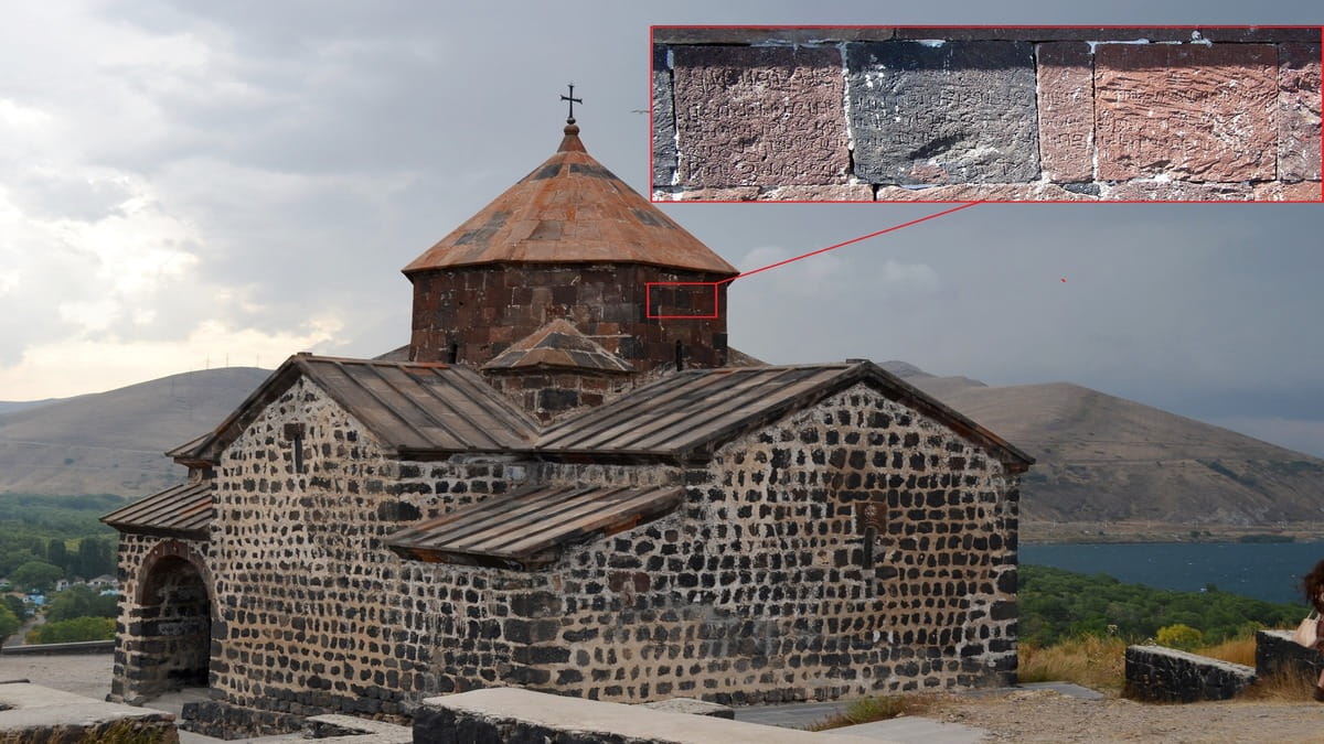
As you can easily see, in the central part is depicted Armenia with its historical borders. Here, it is clearly visible that in the east of Armenia, the borders reach the Kur River, embracing the city of Erivan and the basin of Sevan. In the west, the Armenian lands reach the Mediterranean Sea and cover the Plain of Cilicia, which has remained the main stronghold of the Armenian statehood until 1375.
In the basin of Lake Urmia, within Persia, the Aderbigian province (a Persian historical province) is located. It’s the ancient Atropatene the borders of which, unlike Armenia, are not marked. This Persian province is separated from the Armenian lands by a natural geographical boundary – the Araks River.
In this regard, it is worth mentioning the remark of Greek geographer Strabo about this river as “separating Armenia from Atropatene” (“Geography”, 13. 3.). This map alone destroys all the “arguments” of modern Azerbaijani falsifiers from historical science.
Since we decided to use maps published in France, readers may also get acquainted with the same area, but in a slightly more modern French map bearing the same name – “Turquie d`Asie de la Perse”.

On this map published in 1787, we see that:
- The eastern borders of Armenia reach the Kur River and cover the territories of modern Armenia and the Artsakh Republic, as well as the now occupied Nakhichevan and Utik.
- Within Armenia, a lake called “Sevani” is indicated, which fundamentally destroys the judgments of Azerbaijani falsifiers about “Goycha” as a “true” and “historical” hydronym.
- There is no “Irevan” and, moreover, “Western Azerbaijan” on the map. However, there is the city of Erivan which is again located in the territory of historical Armenia.
- It should be noted that the dotted line denotes the land from Kur to the Mediterranean and Black Seas inclusive, which is the area of settlement of the Armenian people and depicts the historical and ethnic borders of Armenia.
- True Azerbaijan is located in the same place where it has always been – to the south of the Araks River – and covers the area around Lake Urmia.
Based on the above facts, we draw the following conclusions:
- Armenia covered the territories of both banks of Akhurian, as well as the Kur-Araks interfluve along with Artsakh, Utik, Nakhichevan, and the Sevan basin.
- Historical Persian Azerbaijan did not include the territory north of Araks and was limited to the lands around Kaputan (Urmia).
What are the main reasons for deliberate (without doubt) distortions by Azerbaijani scholars about the history and geography of the region? We assume that this is due not only to the politically motivated striving of Azerbaijani science to prove that Transcaucasian Turks are native to the Caucasus but also the need to “substantiate” claims to Armenian lands.
Azerbaijan is included in the “Great Turan” project, which aims to achieve the formation of a single Turkic ethnic-geographical and political space with the subsequent elimination of “barriers” in the form of Armenian states, Tajikistan and, at least, the northern regions of Iran.
In other words, the main role here is played by aggressive Panturanism which is based on plans for the annexation of vast territorial spaces from the Balkans to Siberia, including Transcaucasia, and the annexation projects of an artificially created entity with a name stolen from a neighboring Persian province.
Nikolay Melkumov