Throughout its millennia-long history, Karabakh has been known by different names. In Urartian cuneiform inscriptions, it is referred to as Urtekh-Urtekhini, which corresponds to the traditional Armenian name Artsakh.
Ancient Greek authors referred to this region as Orchistena, equating it to the Armenian Artsakh. Early medieval sources, such as the writings of Movses Khorenatsi, provide two additional names for this region, as the administrative center changed over time: Tsavdek, named after the center of the Principality of Tsavdek, and Khachen, named after the fortress of Khachen. The 13th-century author Vardan explicitly wrote, “Artsakh is [now] Khachen,” which served as the residence for Armenian princes from the Aranshahik dynasty.
From the 10th to 13th centuries, the name Khachen frequently appeared not only in numerous epigraphic monuments of Karabakh but also in Byzantine and Persian nomenclature. The fortress and region were called Khachen (derived from the Armenian word “Khach,” meaning cross), signifying their Armenian inhabitants. The sources mention two more names for Artsakh: Lesser Syunik and Lesser Armenia.
The name Karabakh originated within Persian geographical nomenclature. Unlike the plains known as Bag-i Safid (White Garden), the mountainous part of the region was called Bag-i Siah, which, through Turkic interpretation, became Karabakh (Black Garden).
Greco-Latin sources, dating from the 1st century BCE to the 3rd century CE—authors such as Strabo, Pliny the Elder, Plutarch, Claudius Ptolemy, Appian, Dio Cassius, and others—unequivocally confirm that the boundary between Armenia and Albania followed the Kura River.
Strabo: “In Armenia itself, there are many mountains and plateaus… There are also many plains, such as the Araxes plain, through which the Araxes River flows to the borders of Albania… Beyond this plain lies Sakasena, also bordering Albania and the River Cyrus.”
“Araxes flows through Armenia, while Cyrus flows through Iberia and Albania.” “It [Cyrus] originates in Armenia… and then flows through a narrow valley into Albania; between this valley and Armenia, the river powerfully rushes through the plains…”
Pliny the Elder: “This tribe [Albanians], settled in the Caucasus mountains, extends, as mentioned, up to the River Cyrus, forming the boundary between Armenia and Iberia.”
Claudius Ptolemy: “Greater Armenia is bordered to the north by part of Colchis, Iberia, and Albania, along the aforementioned line that passes through the River Cyrus.”
Plutarch: “When winter overtook the Roman army in this land (Armenia) during the celebration of Saturnalia, the Albanians, numbering no fewer than forty thousand, crossed the River Cyrus and attacked them,” i.e., crossing to the right bank of the Kura.
These accounts are confirmed by later authors. For instance, Stephanus of Byzantium (4th–early 5th centuries) mentions regions of Armenia: “Obarenes—a part of Armenia adjacent to the River Cyrus.” He identifies Otena-Utik as an Armenian region bordering Albania along the Kura River. Another Byzantine source, Menander of Byzantium (late 6th century), writes, “Roman commanders once again entered Albania, forcing the Savirs and Albanians to resettle beyond the River Cyrus…”
Early medieval Armenian authors also mention the Kura as Armenia’s boundary. According to Pavstos Buzand (5th century), the Kura marked the borders of the Mazkut king Sanesan’s lands. The king, the historian writes, “crossed his border, the great River Kura, and flooded the Armenian land.”
Among the Armenian regions that turned against the Armenian Arsacid king, the historian lists Gardmanadzor, the fortified district of Artsakh, which he describes as “the hereditary possession of the Armenian royal house in the land of Atropatene.” He writes about the return of the “captured” districts—Artsakh, Utik, Shakashen, Gardmanadzor, and others adjacent to them: “He [the king] made the River Kura the boundary between his country and Albania, as it had been before.”
In another book recounting the activities of Gregory the Illuminator, Pavstos Buzand writes that Gregory “crossed the River Kura into the barbarian lands of the great king and reached the camp of the Arsacid king of the Mazkuts.” This same territorial composition is confirmed by historian Sebeos.
The territorial composition of Armenia and the borders of Albania, “which lies between the great River Kura and the Caucasus Mountain,” are also detailed in the 7th-century Armenian “Geography” — the “Ashkharhatsuyts.” The Byzantine court, well informed about the situation in neighboring Transcaucasian countries, knew that the Khachen principality was part of Armenia.
Therefore, the Byzantine Emperor Constantine VII Porphyrogenitus (913–959) addressed his official letters to the princes of Khachen and Sevordik as “in Armenia,” reaffirming the Armenian identity of these territories. The Persian-Arabic geographer of the 10th century, Suhrab (Ibn Saraviyun), also refers to the Kura as the river of “inner Armenia” and the Araxes as the river of “outer Armenia.”
In the first half of the 6th century BCE, Artsakh, as part of Yervanduni Armenia, was under the rule of Media, and from 550 to 331 BCE, it belonged to the Achaemenid Empire.
From the late 4th century BCE onward, Artsakh, along with neighboring regions Utik and Syunik, remained within the Armenian kingdom of the Yervanduni dynasty. Its inclusion in the kingdom of Tigran II in 95 BCE is evidenced by the founding of the city of Tigranakert within it. Strabo also describes Orchistena (Artsakh) as a province of Armenia; this is confirmed by early medieval Armenian primary sources.
According to the “Ashkharhatsuyts,” Artsakh was the tenth province of Armenia and consisted of twelve districts (gavars): Aband the Second, Vaikunek, Berdadzor, Mets-Arank, Mets-Kuank, Kharchlank, Mukank, Piank, Parsakank, Kusti, Farnes, and Kolt. After the division of Armenia between the Byzantine Empire and Iran in 387 CE, Artsakh remained part of Armenia until the abolition of the Armenian Kingdom in 428 CE. It was then annexed by the Persians to the Kingdom of Albania, which was located on the left bank of the Kura River. The author of the “Ashkharhatsuyts” mentions that Proper (i.e., left-bank) Albania was situated north of the Kura River, which had long served as the boundary between Armenia and Albania.
After the abolition of the Kingdom of Albania in 469 CE, as noted in the brochure “Nagorno-Karabakh. Historical Overview,” Artsakh remained within the Persian marzpanate established on the territory of this kingdom and neighboring regions, which was named “Albania” (Aran). A century later, in the late 6th to early 7th centuries, the Albanian marzpanate fragmented into smaller principalities in the north. These principalities, named after local tribes or ruling dynasties, abandoned the name “Albania” and the collective term “Albanians,” which had become redundant.
In the south, however, Utik and Artsakh formed a separate Armenian principality under the Aranshahiks (late 5th century) and later under the Mihranid dynasty of Persian origin (7th century). The Mihranids inherited the administrative name “Aluank” (Albania), but this name, having shifted southward from its original location, became purely geographic, reminiscent of the former marzpanate, yet unrelated to “Proper Albania.”
The name “Albania,” when applied to Utik and Artsakh, became synonymous with terms used in the works of ancient Armenian historians, such as “Eastern Region of Armenia,” “Northeastern Region,” “Aluan Region” (i.e., Albanian Region), and “Deep Armenia.”
The historian Matteos Urhaetsi (11th–12th centuries), referring to the “Land of Albania,” clarifies: “which is now called Deep Armenia.” The political and cultural history of these regions forms the core content of the 10th-century Armenian historian Movses Kaghankatvatsi’s work, “History of Albania” (or “History of the Land of Aluank,” as the title is traditionally translated), as noted by the authors of the brochure.
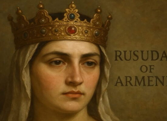
The Persian-speaking anonymous author of the 13th century also provides information about Artsakh—Khachen and the royal dignity of its ruler Hasan Jalal: “The population there is Armenian. The people of Abkhazia call their padishah ‘tagaver’ [king].”
Vakhtang, the son of Hasan Sakarian (from his marriage to Horishah), had three sons and three daughters. The eldest son was named Hasan in honor of his grandfather, and Zakaria and Ivane were named after Armenian princes and commanders of Queen Tamar: Sargis Zakaria and Atabeg Ivane Mkhargrdzeli.
Several epigraphic monuments provide information about the Armenian king of Artsakh—Khachen, Hasan Jalal (1214–1261), and his descendants. In an inscription from 1229, Hasan Jalal appears as the ruler of Artsakh-Khachen: “By the grace of God, I, Hasan, son of Vakhtang and Horishah, built this holy church…”
In an inscription on the wall of Gandzasar Monastery, he details his identity and domain: “I, Jalal Davla Hasan, a humble servant of God, son of Vakhtang, grandson of the great Hasan, the hereditary lord and king of the high and great country of Artsakh and the adjacent region [of Khachen].”
The ruler of Artsakh-Khachen established close relations with the rulers of Mongolia. According to the historian Kirakos Gandzaketsi (13th century): “The wise ishkhan [Hasan Jalal], upon learning of the approach of the infidels, gathered all the inhabitants of his land in a fortress called in Persian ‘Khohanaberd.’
When [the Tatars] came to besiege it and realized that the fortress was impregnable, they proposed a friendly agreement to him. Hasan Jalal wisely accepted their proposal. He then personally went to them with gifts.
The [Tatars], honoring him, restored his domain and even added to it. They ordered him to join their campaigns year after year and to live peacefully under their rule. Hasan Jalal wisely managed his land: he collected everything needed for the messengers arriving in his country—food or whatever else was required. He kept and even added to these supplies, giving them freely when they came, ensuring that the [Tatars] did not oppress the people of his country. Instead, they merely visited him. In other regions, they behaved differently, oppressing wherever they could.”
He enjoyed the patronage of Sartaq, the son of Batu Khan of the Golden Horde, who had converted to Christianity. The historian describes the close relationship between the Armenian prince and Sartaq, Batu’s son: “Among others, the great ishkhan of Khachen and the territories of Artsakh, Hasan, affectionately called Jalal—a pious, God-fearing, and humble man of Armenian descent—came to visit him [Sartaq]. He [Sartaq] welcomed him and all those accompanying him graciously and with respect: Ishkhan Grigor, often called Otroq (though at that time he was already an elderly man), Ishkhan Desam, a modest young man, Vardapet Markos, and Bishop Grigor.
He escorted [Jalal] to his father, treated him with great honor, and restored to him his estates—Charaberd, Akana, and Karkar—that had previously been seized from him by the Turks and Georgians.”
Later, in 1255, after Batu’s death, Hasan accompanied Sartaq to Mongolia to visit the Great Khan Möngke. He himself records this event: “I, Hasan Jalal Dawla, traveled to the king of the archers in the East, to the northern lands, personally with my family and household, for the peace of the church. My wife Mamkan, and my God-given son Atabeg, and I traveled to the northeast, and I went to the edge of the world to the king known as Khan Möngke…”
The historian Kirakos Gandzaketsi writes about Karabakh as part of Armenia and the condition of its Armenian population in later periods. Speaking of the early 15th century under the rule of “Tamerlane’s son,” the German traveler Johann Schiltberger, who visited this region in 1420, notes: “I also spent much time in Armenia. By Timur’s command, I came under his son’s rule, who governed two kingdoms in Armenia.
This son, named Shah Rukh, customarily spent winters on a vast plain called Karabag (Karawag), known for its excellent pastures. It is irrigated by the River Kur (Chur), also called Tigris (Tigris), and along its banks, the finest silk is produced. Although this plain lies in Armenia, it is, nevertheless, ruled by pagans, to whom Armenian villages are forced to pay tribute.”
It should be noted that in a translation published in Azerbaijan, this passage was altered to replace the term “in Armenia” with “in Azerbaijan,” in accordance with their established practice of handling sources.
Information about the rulers of one of the Armenian principalities of Artsakh in the 12th–13th centuries—Khachen—survives in several epigraphic monuments of this period, affirming the Armenian identity of the region and its political ties to Armenia. The lord of the fortresses Aterk, Andaberd, Khachenaberd, and Avkahatak, Hasan, son of Sakar (Zakaria) Vakhtang, headed the Khachen dynasty from 1142. In 1152, he married the daughter of King Kyurike, one of the last representatives of the Lori branch of the Armenian Bagratuni royal family.
One of his sons, Vakhtang, the lord of Lower Khachen, nicknamed Tonkik, married the daughter of Sargis the Great—one of two famous military and political figures of Queen Tamar of Georgia.
The author of the “Armenian Law Book,” Mkhitar Gosh, who had close ties with Princes Hasan Jalal and his son Vakhtang, referred to them as “chief among other princes” and equated them to Prince Ruben of Cilicia. Highlighting their political role, the Armenian jurist noted that “in the days of lawlessness in our (i.e., Armenian) kingdom… few princes remained from ancient times in the region of Khachen.”
Hasan Jalal is also reported to have “set out to present his complaint to the Mongol ruler” concerning the oppression by tax collectors and the governor Arghun.
Turkic tribes began appearing sporadically in Western Asia as a result of invasions by nomadic peoples of Asia—the Seljuks (1048, 1049, 1054, 1065), Tatar-Mongol hordes (1236–1243), Golden Horde Khan Tokhtamysh (1385), and Tamerlane (1386, 1394, and 1400).
Following the invasions of the South Caucasus by Timur’s forces between 1386 and 1405, Northern Iran and Armenia fell under the control of the Turkoman dynasty Kara Koyunlu in the first half of the 15th century and Ak Koyunlu in the second half. However, the Hasan Jalal dynasty did not cease; its members retained the title of melik in several small principalities of Nagorno-Karabakh in the 16th–18th centuries. The plains (lowlands) of Karabakh, particularly the Mughan Steppe, came under the control of Turkic newcomers.
During the Safavid dynasty’s rule in Persia, Karabakh became one of its provinces (beglarbekate). The lowlands and foothills of Karabakh were governed by Muslim khans, while the highlands remained in the hands of Armenian rulers.
The system of Armenian meliks was fully developed in Nagorno-Karabakh during the reign of Shah Abbas I of Persia (1587–1629). During this period, Persian authorities encouraged Armenian meliks to take active measures against the Ottoman Empire.
At the same time, the Persian rulers sought to weaken the Armenian meliks by isolating them from other Armenian territories by resettling Kurdish tribes in the area located between Artsakh and Syunik.
Excerpt from the book by Y. Barsegov: Nagorno-Karabakh in International Law and World Politics
Artatsolum