The western part of Sasun is occupied by the district of Hulb, a name that is a dialectal variation of Kohb. The Hulb district is situated in the basin of the Kakhird (Ba-Tman, the largest left tributary of the Tigris) and its left tributaries, Hulba and Pasor. The district’s center is the village of Hulb or Pasor, located in the lower interfluve of these two rivers.
The name Kohb-Hulb is recorded in Hittite and Assyrian cuneiform inscriptions as Uliba, while Pasor is a dialectal variant of Basor, which in several ancient languages, including Armenian, meant a village or trading center. Later, in Turkish distortion, Basor became Bazar. Interestingly, in Kurdish, Bajjar retains a meaning close to the original – a settlement.
In the 19th and 20th centuries, the Hulb district extended north to the Aratsani River in the area where the village of Gandzaberd or Gendzh is located. Since the latter was the center of a separate district, the northern part of Hulb was often included in it. The most significant village in northern Hulb-Gendzh is Artushen, on the left bank of the Aratsani, 7 km northwest of Gandzaberd-Gendzh.
In the past, Artushen was a large city occupying a significant territory. Apologies for the frequent use of double and even triple names, but this is how our history has unfolded—most Armenian toponyms now bear foreign-distorted names.
In northern Hulb, there are several important villages. For example, in Apiana (Abdial) was the summer residence of Sasuntsi David. Near the large village of Indzkar, on the right bank of Hulba, is the Monastery of Indzkaru Surb Gevorg, a beloved pilgrimage site for Sasun Armenians and Kurds.
The village near the monastery is now called Derik, from the Armenian-Assyrian Der, Deyr – desert, monastery, holy place. The etymology of the toponym Indzkar, like that of the Rshtunik Indzakisar, traces back to the Armenian “intza” – gift, offering, with the meaning “bestowed from above.”
The people associate the name Indzkar with the phrase “antz kar” (stone with a gap or passage). Indeed, near the village rises a solitary rock with a crevice through which, according to local tradition, women wishing to conceive had to pass.
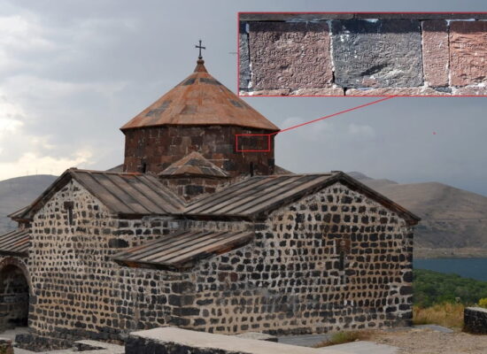
The courtyard of the Surb Gevorg Monastery was paved with white marble slabs. Sasun people particularly recall the monastery’s remarkable acoustics.
Further downstream, on the left bank of Hulba, 3 km from the river, lies the large village of Aharonk or Handzi. Here in 1864 was born the famous fedayee Jokhkh Hrayr (Armenak Kazaryan), who was buried in Inkuzadzor-Gelieguza after dying in a battle with overwhelmingly superior Turkish forces in 1904.
In the early 20th century, Aharonk had up to 90 Armenian homes, two churches—Yot Manuk and Surb Astvatsatsin—and a school with 60-70 students, whose building was constructed by Vardapet Vardan Akopyan with funds from the Armenian United Society.
Aharonk was one of the wealthiest and most prosperous villages in Sasun, with most of its homes being two-story. The surrounding mountains have resonant names like Satani Kit (Devil’s Nose), Ardjkarer (Bear Stones), and Sarbanda Kaj (Flat Mountain).
East of Hulb, between it and Talvorik, lies the district of Hiank, occupying the lower basin of the Andokajur-Talvorik River, between the Kakhird and Sasnodjur rivers. The toponym derives from the center of the district—the village of Egin or Hegink, located 9 km southeast of Aharonk.
The village had the Monastery of Surb Eghia Margare, a very popular pilgrimage site in Sasun. Every seven years, the residents of Egin and nearby villages would go to the surrounding forest, gather green branches, and cover the monastery roof with them. This event was called “tambum” – from the word “tamb,” saddle (i.e., “saddle” the roof).
Egin is situated on the right bank of the Hiank River, a tributary of Talvorik, and further upstream is one of the most significant villages of Hiank and all of Sasun—Ishkhanadzor or Ishkhandzor. It stretches along the gorge of the river of the same name, on the opposite slopes of the Talvorik mountains, Shtorkar and Spitaksar.
The village’s districts, called takhs, are located quite far apart and are named Midjin Takh, Norhan, Galink, Khrvard, and Khzrku Arter. In Midjin Takh and Norhan, there are the churches of Surb Mamas, Talila, and Tukh Manuk, and near Khzrku Arter is the chapel of Oski Tur (Golden Sword).
Overall, Ishkhandzor had about 90 Armenian homes. In the same gorge are the villages of Sevit and Inkuznak. In the next gorge to the south lies the village of Arthonk or Artkonk (now Tahnaval), which has seven takhs—named after the seven founding brothers, according to legend.
A canal, arou, lined with whitish local stone from Spitaksar’s springs, supplied the village with water. Further south, at the border of Talvorik and Psank, at the foot of Mount Kurkank, lies the heroic village of Berm, which offered prolonged resistance to Turkish troops in 1895. In 1914, Berm had 150 Armenian homes and two large domed churches—Surb Astvatsatsin and Surb Gevorg—as well as a school.
The nearby village of Ashter (Hashter) preserved in its name the ancient goddess Astarte (Armenian Ashtar). Other notable villages in Hiank include Khrut on the right bank of Sasnodjur with the Monastery of Surb Astvatsatsin; Sahtun, Shukhek, and Khndzorak southwest of Egin, once populous and lively; Mamikonk, Garnadzor, and Gerger on the southern left bank of Kakhird; Tandzi near Berm; Pahmtank or Ba-Meydan in the Takhvudzor forest (not to be confused with the village of Takhvudzor in the Khut district) with the church of Karasun Manuk.
In the southernmost part of Hulb and Hiank (and all of Sasun), 2 km below the confluence of the Kakhird (Ba-Tman) and Sasnodjur rivers, lies one of Armenia’s most interesting and significant ancient bridges—Pra-Batman or Malabade. Pra (pre) in Kurdish means bridge and traces back to the ancient Armenian “bra”—prehistoric, fossil (Brajur—ancient water, “bratso”—fossil, etc.).
“Mala,” as previously noted, is Hittite for “house by the water.” Thus, both names of the bridge mean Batman’s or Bada’s bridge or house. This toponym originates from the name of the ancient country among the Naïri lands—Tman, Tmnis. Prefixes Ba, Bit are among the oldest designations of territories, countries, and regions. Ba-Tman translates from ancient Armenian and Aramaic as the Land of Tman.
However, popular etymology creates its own analogies and traditions, often centuries old and sometimes quite clever and entertaining. The name Pra-Batman in Sasun tradition is associated with a master named Batman, who experienced various adventures while building his bridge. Regardless, the construction of the bridge dates back to ancient times, as indicated by its name’s etymology.
This monumental structure is a jewel of Armenian engineering thought and one of the largest in the ancient world. The single-arched bridge stands about 5 meters above the Kakhird River, with a length of 60 meters and a width sufficient for two cars to pass side by side (the Pra-Batman bridge is still in use today).
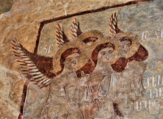
The bridge’s supports on both banks have built-in guardhouses with Armenian inscriptions. One of the most famous stories associated with Pra-Batman is the epic of Sasna Tsrer, where David of Sasun, upon returning home, lifted two giants—Mser Melik’s warriors—by the scruffs of their necks and hung them upside down from the bridge after suspecting their intent to throw him into the river.
On the right bank of the lower Kakhird, between the river and the Tigranakert Mountains, lies the Patkank district (Badikan). Strictly speaking, it does not belong to Sasun but rather to Tigranakert. However, Patkank is often mentioned along with Hulb and geographically leans toward the Sasun natural region.
In Patkank, the main attraction is the ruins of the ancient city and temple of Haldi near Tigranakert-Silvan, 8 km northwest of it, among rocky and harsh mountains on the slopes of the Arpad and Kolosik peaks.
Known as Altini in ancient cuneiform inscriptions, Haldi is an ancient Armenian deity whose cult was particularly widespread during the Van Kingdom era, giving its name to the Chaldean people. Mount Arpad, on whose southern slopes the city of Haldi was situated, is a precursor to the Mesopotamian Arpad.
In the vicinity of Haldi, among the rocks and flint-like stone formations, referred to in Armenian as “kaytskar” (spark-stone), is a place known as Koler. According to the epic of Sasna Tsrer, this is where Sasuntsi David would sharpen his famous Tur-Kaytsak (Lightning Sword).
Among the significant villages in Patkank are Dzayntkni at the foot of Mount Dzaynkar. The Armenian name of the village and the mountain translates to Thunderous Stone and Foot of Thunder, respectively (names related to the noise of rockfalls and the howling of the wind).
Many similar toponyms in Armenia have been slightly altered to fit a Turkish pronunciation: dzayn (sound) becomes zeyn, zeyni, thus Turkifying the ancient Armenian toponym.
In conclusion, the western part of Sasun, particularly the district of Hulb, is rich with historical and cultural significance. From its ancient Armenian roots, as evidenced by the Hittite and Assyrian cuneiform inscriptions, to the thriving villages and monasteries of the 19th and 20th centuries, this region holds a unique place in Armenian history. The numerous sacred sites, ancient fortresses, and enduring traditions reflect the resilience and enduring spirit of the Armenian people. The archaeological and cultural heritage of this area continues to offer valuable insights into the ancient and medieval periods of Armenia, ensuring that the legacy of these historic sites is preserved for future generations.
Artatsolum
Based on an article by Grigor Beglaryan