In the eastern part of Greater Armenia, specifically in the province of Artsakh, which historian Movses Kaghankatvatsi of the 7th century referred to as the Eastern Side of Armenia (Arevelits Kohmank Ayots), Tigran the Great (Tigran Mets) founded three cities bearing his name. Two of these cities are located within the Republic of Artsakh, while the third awaits its discovery in Gardman—Northern Artsakh.
Today, active excavations are underway in the so-called Middle Artsakh Tigranakert, a city located roughly midway between the other two. This city is commonly referred to in scholarly and other literature as Artsakh Tigranakert. However, this name is not entirely accurate, as there were three Tigranakerts in Artsakh. Geographically, it would be more precise to name these cities Northern, Middle, and Southern Artsakh Tigranakerts.
Middle Artsakh Tigranakert
Middle Artsakh Tigranakert is located in the Martakert district of the Republic of Artsakh, on the right bank of the Khachenaget River, on the southern slope and at the foot of Mount Vankasar. Mount Vankasar rises to 681 meters above sea level and features the beautiful chapel of Vankasar or Spitak Ptuk at its summit.
On the northern and northeastern slopes of Vankasar lies the village of Nor Maraga, known as Kankar in medieval Armenian times. This name was commonly given to areas with an abundance of the eponymous herb kankar, which resembles thistle.
Adjacent to the Tigranakert site are the ruins of two ancient Armenian villages—Arkayakan and Tarnagyut. The former was named after a nearby abundant spring—Arkayats Akn, meaning Royal Spring, which was later translated into Persian as Shah-Bulag. The latter name is a dialectal variant of Tigranakert—Tkrnakert or Tarnagyut.
A road from Stepanakert to Martakert passes just east of Middle Artsakh Tigranakert. Three kilometers to the southwest lies the Khachen Reservoir, the village of Armenakavan, and Mount Yot Krmants (Seven Priests). Four to five kilometers to the south are the town of Aghna and the developing village of Surenavan.
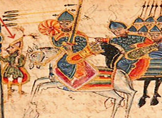
Middle Artsakh Tigranakert was founded by Tigran the Great in the 90s BCE as an eastern outpost of the Armenian Empire and existed for nearly 1000 years before being destroyed in the 10th century. According to Movses Khorenatsi, in the 4th century, the Syunik prince Andovk Syuni, father of Queen Parandzem, successfully resisted Persian attacks for an extended period from this city, which was then under the jurisdiction of Syunik.
In 2005, the Institute of Archaeology and Ethnography of the National Academy of Sciences of Armenia organized excavations here, led by Dr. Hamlet Petrosyan, which continue to this day. In 2008, Middle Artsakh Tigranakert and its surroundings were designated a state reserve, and in 2010, an Archaeological Museum was inaugurated there.
Thus, created at the dawn of our era by the Armenian genius, liberated at the end of the 20th century by heroic Armenian blood and restored in our days by Armenian science, the Artsakh Middle Tigranakert has become not only a symbol of the invincible Armenian spirit, but also a major tourist center of the Republic of Artsakh, a center of pilgrimage for Armenians from all over the world.
The Tigranakert Archaeological Museum in three spacious halls widely displays a wide variety of artifacts discovered during excavations and dating from the period from the 5th century BC to the 17th century AD, as well as ceramics from the beginning of the 2nd millennium BC, testifying that Tigran Mets founded the city on the site of an ancient settlement.
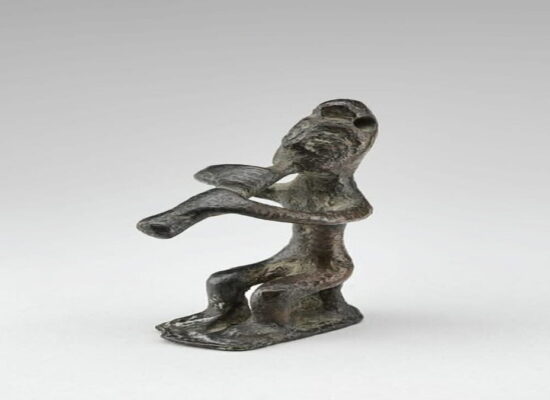
Among the most unique finds are two churches and a crypt from the early Christian period, a fortress with masonry made of large stones fastened together using the “dovetail” method, remains of sculptures and ornaments from the most ancient period, including a ram’s head – “khoyi gluh”, the cult and name of which in ancient Armenian served as the basis for the late Turkic “koyunlu”, and much more.
The ongoing excavations in the Middle Artsakh Tigranakert are a vivid example of how science can shed light on previously unknown pages of history, provided that the subject of the study is not in the hands of barbarians trying to squeeze into someone else’s place, but the true owners of a multi-thousand-year-old civilization…
The Second (or Southern) Artsakh Tigranakert is located in the extreme south of Artsakh, in the mountains on the left bank of the Araks River – this is the eastern end of the Arevik (Meghri) ridge. The ruins of the city, as well as the ruins of the Middle Artsakh Tigranakert, are called Tarnagyut – this is the Artsakh dialect form of the toponym.
These ruins are located two kilometers south of the ancient Armenian village of Tsob – during the years of the Azeri occupation it was called Sobu, and four kilometers west of another ancient village – Tsobadzor (former distorted form – Chopedere).
Both of these names refer to the earliest period of Armenian history and the Armenian language, testifying to our presence here as early as the 4-5 millennia BC. Tsob in ancient Armenian is a holy place, temple or grove dedicated to the gods, from Tsob subsequently came the Armenian Tsov (the name of the Sasun mountain Tsovasar, for example, does not mean “Sea Mountain”, but “Holy Mountain”, and the Artsakh village Tsovatekh means “Holy Place”, and there is no need to look for shells and sediments of ancient seas here), Arabic Sufi (“holy”, “pure”), the Christian name Sophia, etc. When meeting with any Tsob or Tsobadzor, Tsovasar on the Armenian Highlands, you should look for the remains of a temple, a pagan temple nearby, and if there are forests in the area – traces of holy groves and trees. And in the case of our Tsob, the sacred ancient meaning of the toponym is supplemented by the meaning of the “holiness” of the city founded by Tigran the Great – by the way, both the village and the ruins of Tarnagyut-Tigranakert are located in the forest, on the banks of the left tributary of the Araks – the Tsobadzor River, not far from the large settlement of Bardutakh, which means “Poplar Side”.
In the pre-Christian period of Armenian history, poplar, along with sose (plane tree or plane tree), was a sacred tree. Due to the remoteness from normal roads, the lack of infrastructure, Tsobadzor and Bardutakh occupy, let’s say, not the most central place in the plans of the Artsakh leadership and in the scientific developments of future excavations, although they promise, it seems, no less sensational discoveries in the case of a serious approach.
And the Southern Artsakh Tigranakert – this Araks stronghold of Tigran Mets, which protected the interior of Artsakh and Syunik from the raids of the Caspian tribes, we hope, will soon take its rightful place not only on the maps.
The third, or Northern Artsakh Tigranakert, is still in a much more unfavorable situation than the Middle and Southern – it is located outside the borders of today’s Republic of Artsakh, namely in Northern Artsakh – Gardmank, occupied by Azerbaijani forces.
Naturally, as in the case of hundreds of Armenian villages and tens of thousands of Armenian monuments in a similar situation, Northern Artsakh Tigranakert is perishing, if it has not already perished like the Djuga khachkars or the Aprakunis temple. Its ruins are located on the left bank of the middle reaches of the Charekadjur or Shamkor River – one of the large right tributaries of the Kura, which flows north from the Sevan ridge.
Nearby are two large and significant Armenian villages of Gardmanka – Barum and Barsum. The settlement itself is located slightly to the east of Barum, at the confluence of the left tributary of the Charekadjur, the Tsakarijur River.
Over time, around the once flourishing, then destroyed city of Tigranakert, a small village of Garnakert grew up, the name of which, being originally a dialect form of Tigranakert (along with Garnakert, the form Tkrnakert was also used), over time acquired the meaning of “gar” (sheep).
In modern times, Garnakert became part of the village of Barum, forming its lower, riverine part (Nerkin Barum). Immediately to the south of Garnakert, on the left bank of the Charekajur, are the ruins of the medieval Armenian monastery of Tsaghkotsavank, and further to the south, upriver, are the ruins of the monasteries of Khreshtakapetats and Charekavank and the fortress of Mamrot.
All these monuments, as well as several dozen surrounding villages, formed the backbone of the Armenian gavar of Gardmank in the Middle Ages, the more ancient name of which is Parisos. In fact, Northern Artsakh Tigranakert was founded by Tigran as the northern outpost of the center of this gavar – the berdavan of Parisos or Gardmanaberd (now Kalavan or Kalakend), to protect it from the northern lowland near the Kura.
Along with Shamkor and Gandzak, Northern Artsakh Tigranakert was one of the large and lively centers of Gardmank, which after its destruction was divided into large and significant villages of Barum, Upper and Lower Barsum and Garnakert-Tkrnakert. From the south – from the side of the Sevan ridge, one of the significant passes of this part of Armenia – Durn Parisosi (Parisos Gate) or the Satanakhach pass leads to the valley of Charekajur and to Tigranakert.
Artatsolum
Based on an article by Grigor Beglaryan